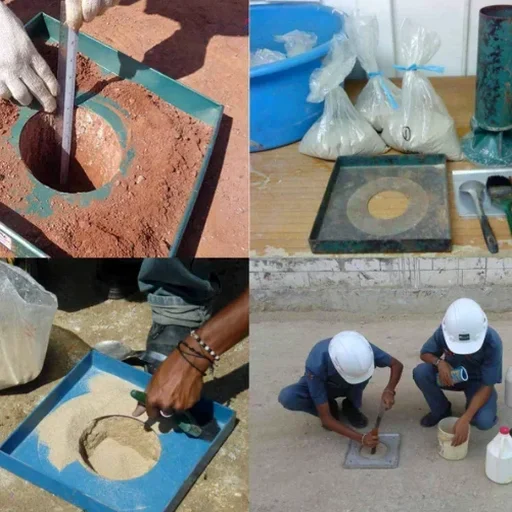
The soils beneath a construction site in Chevy Chase rarely match what you'll find over in the Hamburg Pavilion area. Lexington's geology shifts dramatically across short distances, from deep residual clays derived from the Ordovician limestone bedrock to pockets of alluvial silts tracing historic creek beds. This variability is precisely why field density verification isn't just a box to check. It's the only way to confirm that the soil you're building on actually meets the engineered compaction requirements. A laboratory Proctor curve tells you the maximum dry density achievable under controlled conditions. The field test tells you if the contractor's roller and moisture conditioning achieved it in the real world. We apply the sand cone method per ASTM D1556 across Fayette County because it remains the most direct and defensible measure of in-place density. For sites where deeper stratigraphic control is needed, we often recommend pairing the test with SPT drilling to verify that the subsurface conditions match the geotechnical baseline before compaction even begins.
A Proctor curve is theoretical. A density gauge is indirect. The sand cone gives you the physical volume and mass of soil removed from your compacted lift.