GEOTECHNICAL ENGINEERING
LEXINGTON
HomeUnderground ExcavationsGeotechnical excavation monitoring

Geotechnical Excavation Monitoring in Lexington, KY

Evidence-based design. Reliable delivery.

LEARN MORE

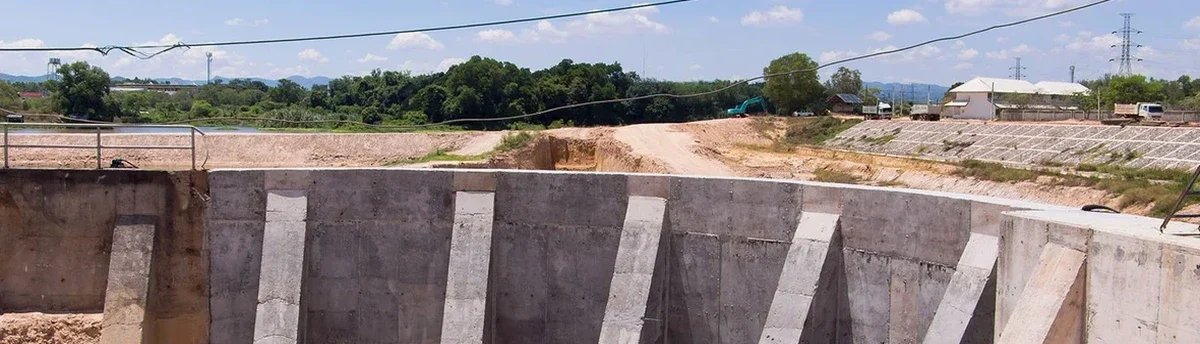
What catches contractors off guard in Lexington isn't just the limestone — it's the way the residual clay holds water after a week of rain, then shrinks and cracks when August hits. We've tracked excavation walls in the Inner Bluegrass where lateral movement spiked 40% two days after a summer thunderstorm, simply because the drainage plan assumed constant moisture conditions. The MASW survey helps map the clay-over-rock interface before the first bucket goes in, but day-to-day monitoring is what keeps the shoring system honest. Lexington's geology transitions fast from stiff Maury silt loam to weathered limestone pinnacles, and a benched cut that looks stable on a Friday can shift by Monday if the ground isn't being read correctly. Our team runs inclinometer and settlement arrays tied to automated data loggers so you're not guessing — you're seeing real-time deformation against the IBC threshold limits.

A Lexington excavation wall in Bluegrass clay can move 40% more after a summer storm than the drainage plan predicted — real-time monitoring catches the shift before it becomes a backfill order.

Our service areas

How we work

The freeze-thaw cycles between December and March put Lexington excavations through a stress test that shallow footings never experience. When overnight temps dip below 20°F and the exposed clay face heaves, then thaws by noon, the shoring tiebacks can lose 15-20% of their preload capacity within a single season. That's why our monitoring protocols layer automated total station readings with manual crack gauge checks at the setback line — redundancy matters when the soil is a karst-influenced residual clay with unpredictable solution channels. We calibrate to ASCE 7 ground motion parameters for Fayette County and cross-check with deep excavation design assumptions to confirm that bracing loads are staying within the envelope. The data stream feeds a dashboard the site super can check from a phone, which eliminates the lag between a displacement event and the decision to stop work or reinforce.
Geotechnical Excavation Monitoring in Lexington, KY
Technical reference — Lexington

Local geotechnical context

The most common mistake we see on Lexington jobsites is treating the monitoring plan as a checkbox deliverable — install three targets, take a reading once a week, file it. That approach misses the real failure mode around here: progressive raveling at the clay-limestone contact. When a cut exposes that interface, water migrates along the rock surface, softens the clay above, and small sloughs turn into undercutting that destabilizes the entire bench. We caught exactly this on a cut near Richmond Road where the contractor assumed the weathered rock face was self-supporting; the inclinometer showed a 12 mm drift over four days, and we got the bench regraded before the shoring load transferred to the adjacent building. In karst terrain like Fayette County, a well-placed piezometer string paired with surface settlement monuments is not optional — it is the difference between a controlled excavation and a morning call to the insurance carrier.

Need a geotechnical assessment?

Reply within 24h.

Email: contact@geotechnicalengineering.biz

Regulatory framework

ASCE 7-22 Minimum Design Loads, IBC 2021 Chapter 33 — Safeguards During Construction, ASTM D653 — Terminology for Soil, Rock, and Contained Fluids, OSHA 1926 Subpart P — Excavations

Reference parameters

ParameterTypical value
Inclinometer accuracy±0.25 mm/m
Settlement point precision±0.5 mm
Crack gauge resolution0.1 mm
Automated reading frequencyEvery 15–30 min
Piezometer range0–100 psi
Data reportingWeb dashboard + SMS alerts
Applicable codeIBC 2021 / ASCE 7-22
Typical monitoring duration3 weeks to 8 months

Questions and answers

What does geotechnical excavation monitoring cost for a typical Lexington project?

For a standard monitoring setup in the Lexington area — including a few inclinometer casings, settlement points, and a piezometer with monthly reporting — budgets typically run between US$920 and US$2.670 depending on the depth of the cut, the number of instruments, and the project duration. Deeper excavations with automated data loggers and daily dashboard access push toward the upper end of that range.

How quickly can you deploy monitoring equipment once the excavation starts?

We can usually have inclinometer casings and survey monuments installed within 48 hours of receiving the go-ahead in Fayette County, assuming access is clear and the initial bench is cut. The key is getting baseline readings before the excavation goes deeper than about five feet, because that's when the stress relief starts showing in the data.

Do Lexington building departments require excavation monitoring for deep cuts?

The Lexington-Fayette Urban County Government typically requires a monitoring plan when the excavation is deeper than 15 feet or when it's within a distance equal to the excavation depth from an adjacent structure. The plan must reference IBC Chapter 33 and show threshold values for lateral movement and settlement. Our reports are formatted to meet that submittal standard directly.

Location and service area

We serve projects in Lexington and surrounding areas.

View larger map