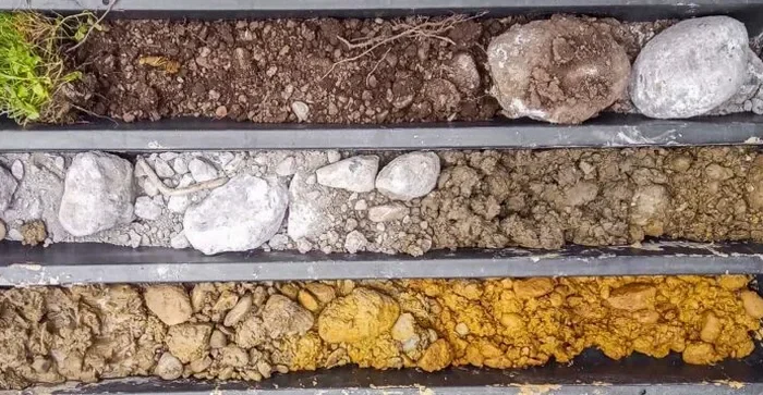
The soil profile beneath a site off Harrodsburg Road rarely resembles what you find three miles east near Hamburg Pavilion. Lexington straddles a geological boundary between the phosphatic Inner Bluegrass and the shale-rich Outer Bluegrass, producing abrupt changes in residuum depth and limestone pinnacle frequency within a single city block. An exploratory test pit in Lexington cuts through the grass, roots, and fill to expose the weathered sequence directly. Crews log the contact between stiff clay and fractured bedrock, measure layer thicknesses by hand, and extract bulk samples for laboratory classification. The approach works well in the tight setbacks of Chevy Chase homes and on horse farm expansions where drill rig access is limited. Combined with grain-size analysis, the pit data confirms whether the fine fraction is fat clay or lean silt, a distinction that controls footing design across Fayette County.
An open excavation reveals what no core barrel can: the true fabric, moisture condition, and heterogeneity of the soil mass.